Welcome to our comprehensive guide on earthquakes in Panama and Costa Rica, where we explore the seismic activity in Central America. These two countries are located in a highly active tectonic region, making it essential to understand the nature of earthquakes and the measures in place to ensure the safety of communities.
Repeating earthquakes and monitoring systems provide valuable insights into fault physics and the behavior of seismic events. In this guide, we will delve into the fascinating world of earthquakes, examining the causes, historical data, monitoring techniques, and safety measures implemented in Panama and Costa Rica. Join us as we uncover the science and impact of these natural phenomena.
Key Takeaways:
- Costa Rica experiences repeating earthquakes, providing valuable information about fault physics and variations in mechanical properties.
- The country has invested in a dense network of seismological and geodetic instruments to monitor tectonic processes.
- The subduction of the Cocos plate underneath the Caribbean plate and the Panama block in Costa Rica leads to a high rate of seismicity.
- Earthquake early warning systems can provide valuable seconds to minutes of warning before strong shaking reaches a specific location.
- Earthquake preparedness and safety measures are crucial for minimizing the impact of seismic events on communities.
Repeating Earthquakes in Costa Rica
Repeating earthquakes, characterized by seismic events occurring in the same location at different times, have recently been observed in Costa Rica. These repeated occurrences provide important insights into fault physics and variations in the mechanical properties of the fault faces. In particular, the central Pacific, the Central Valley, and the Talamanca range have witnessed these highly identical seismic fingerprints.
By studying these repeating earthquakes, scientists can better understand the behavior of faults during the earthquake cycle. The observations shed light on the intricate interactions between the fault faces and provide valuable information about the mechanical properties at play. Although repeating earthquakes have been previously documented along the Nicoya Peninsula megathrust since 2008, these recent findings on inland faults are significant and expand our understanding of seismic activity in Costa Rica.
Characteristics of Repeating Earthquakes in Costa Rica
| Location | Observations |
|---|---|
| Central Pacific | Frequent occurrence of repeating earthquakes, indicative of fault movement and interaction. |
| Central Valley | Repeating earthquakes provide insights into variations in the mechanical properties of fault faces within the region. |
| Talamanca range | Highly identical seismic fingerprints suggest consistent fault behavior in the area. |
The study of repeating earthquakes in Costa Rica contributes to a broader understanding of fault dynamics and seismic hazard assessment. By analyzing these seismic events, scientists can refine earthquake forecasting models and improve preparedness measures. This knowledge is essential for mitigating the impact of future earthquakes and ensuring the safety and resilience of communities in Costa Rica.
Earthquake Monitoring in Costa Rica
Costa Rica has invested significantly in earthquake monitoring, utilizing state-of-the-art geodynamic control networks managed by the Volcanological and Seismological Observatory of Costa Rica (OVSICORI-UNA). This network consists of over 70 sites equipped with broadband seismic stations, strong motion stations, and continuously-recording GPS stations. With such a dense network, Costa Rica boasts one of the most extensive geophysical instrumental networks in Latin America and the world.
The availability of seismological and geodetic data has greatly advanced the understanding of earthquake processes in Costa Rica. Seismic data, collected from the broad network of seismic stations, allows for the detection and analysis of seismic activity in real-time. This data, combined with geodetic measurements from GPS stations, provides valuable insights into the behavior of faults and the tectonic processes occurring in the region.
The continuous monitoring and analysis of seismological and geodetic data enable scientists to identify patterns, track seismic activity, and assess potential hazards. By studying earthquake occurrence and movement along fault lines, scientists can develop models to predict future seismic events and better understand the potential impact on communities. This knowledge is crucial for implementing effective mitigation strategies, improving earthquake preparedness, and ensuring the safety of the population.
Real-time Monitoring and Immediate Response
In addition to the extensive seismic and geodetic networks, Costa Rica also has a system in place for real-time transmission and analysis of seismic data. This allows for rapid response and immediate alerts in the event of an earthquake. By having access to real-time information, authorities can quickly assess the magnitude and potential impact of an earthquake, providing timely warnings to affected areas and enabling individuals to take appropriate safety measures.
Subduction and Seismic Activity in Costa Rica
Costa Rica is located in a region of high seismic activity due to its position along the subduction zone. The subduction of the Cocos plate underneath the Caribbean plate and the Panama block results in a complex tectonic environment, leading to frequent earthquakes. Megathrust earthquakes, which occur along the subduction interface, are a significant hazard in the region, with a recurrence interval of approximately 40 to 60 years.
This subduction process generates immense stress along the plate boundary, causing the accumulation of energy over time. When the stress reaches a critical point, it is released in the form of an earthquake. The energy release can be catastrophic, resulting in significant ground shaking and potential damage to infrastructure and communities.
| Location | Magnitude | Year | |
|---|---|---|---|
| 1 | Limón | 7.7 | 1991 |
| 2 | Managua, Nicaragua | 6.2 | 1972 |
| 3 | San José | 6.3 | 2009 |
| 4 | Golfito | 7.0 | 1983 |
In recent years, seismic monitoring and research in Costa Rica have significantly advanced our understanding of the subduction process and seismic activity. Scientists utilize state-of-the-art seismological and geodetic instruments to monitor and study the behavior of earthquakes. These instruments, including broadband seismic stations and continuously-recording GPS stations, provide crucial data for earthquake early warning systems and hazard assessment.
Understanding the subduction and seismic activity in Costa Rica is essential for implementing effective earthquake preparedness measures. By combining ongoing research, advanced monitoring technology, and community education, we can strive towards reducing the potential impact of earthquakes and ensuring the safety of individuals and infrastructure.
Earthquake Early Warning Systems
Earthquake early warning systems play a critical role in mitigating the impact of seismic events and ensuring the safety of communities. These systems utilize seismic networks to detect and analyze earthquake activity in real-time, providing advanced alerts to areas that will be affected by the shaking. By utilizing the seismic data collected from a network of seismometers, these systems can estimate the magnitude and location of an earthquake and quickly disseminate warnings to relevant authorities and the public.
The implementation of earthquake early warning systems has proven to be effective in providing valuable seconds to minutes of warning before strong shaking reaches a specific location. This advanced notice allows individuals and organizations to take immediate safety actions, such as seeking shelter, shutting down critical infrastructure, or activating emergency response protocols. The availability of earthquake early warning systems has the potential to save lives and minimize damage by enabling proactive measures to be taken in the face of a seismic event.
One of the notable earthquake early warning systems is the ShakeAlert system in the United States. ShakeAlert is a collaborative effort between the United States Geological Survey (USGS), universities, and state agencies. It provides real-time earthquake information and alerts for the West Coast states, including California, Oregon, and Washington. Through a network of seismometers, this system detects and analyzes seismic activity, issuing alerts to a wide range of stakeholders, including emergency management agencies, transportation authorities, and the general public.
While earthquake early warning systems are valuable tools, it is important to note that they provide warning time that varies depending on the distance from the earthquake’s epicenter. The further away from the epicenter, the longer the warning time. Additionally, the effectiveness of these systems relies on the availability of a robust and well-maintained network of seismometers and the infrastructure to receive and disseminate alerts. Ongoing investments in monitoring technology and improvements in data transmission capabilities are crucial for enhancing the accuracy and timeliness of earthquake early warning systems.
Earthquake Preparedness and Safety Tips
Earthquakes are natural disasters that can occur without warning, causing widespread destruction and posing a significant risk to human life. It is crucial to be prepared and knowledgeable about earthquake safety measures to minimize the potential impact of these seismic events. Here are some essential earthquake preparedness tips and safety measures to keep in mind:
Create an Emergency Plan
Creating an emergency plan is essential for every household. Sit down with your family members and discuss a clear evacuation plan in case of an earthquake. Identify safe areas in your home, such as under sturdy furniture, away from windows and heavy objects. Establish a communication plan and designate a meeting point outside your home. Ensure that every family member knows how to turn off utilities, such as gas and electricity, to prevent additional hazards in the event of an earthquake.
Secure Heavy Furniture and Objects
During an earthquake, heavy furniture and objects can become dangerous projectiles, causing injuries or blocking escape routes. Secure bookshelves, cabinets, and other heavy furniture to the wall using brackets or straps. Avoid hanging heavy objects, such as mirrors or framed pictures, above beds or seating areas. Store breakable items on lower shelves to prevent them from falling and causing injuries during an earthquake.
“Drop, Cover, and Hold On”
When an earthquake strikes, remember the mantra “Drop, Cover, and Hold On.” Drop to the ground to prevent being knocked over by the shaking. Take cover under a sturdy piece of furniture, such as a table or desk, and protect your head and neck. Hold on to the furniture until the shaking stops. Avoid doorways, as they are not necessarily safer and may cause injuries. If you are outdoors or in a vehicle, move to an open area away from buildings, trees, or power lines.
By following these earthquake preparedness tips and safety measures, you can better protect yourself and your loved ones during seismic events. Remember to stay informed about earthquake risks in your area and take proactive steps to ensure your safety. Being prepared can make a significant difference in mitigating the impact of earthquakes and promoting community resilience.
Earthquake Detection Systems
Earthquake detection systems play a crucial role in monitoring seismic activity and providing early warnings to communities at risk. These systems rely on seismometers, sensitive instruments that measure ground motion caused by seismic waves. By strategically placing seismometers in seismic networks, scientists can detect and record earthquakes in real-time, enabling rapid response and analysis.
Seismometers are designed to detect even the smallest vibrations in the Earth’s crust. When an earthquake occurs, the ground shakes, generating seismic waves that travel through the Earth. Seismometers pick up these waves and convert them into electrical signals, which are then recorded and analyzed. By analyzing the data collected by seismometers, scientists can determine the location, magnitude, and other characteristics of an earthquake.
Modern earthquake detection systems utilize advanced monitoring technology, allowing for the real-time transmission of seismic data. This enables scientists to quickly assess the impact of an earthquake and provide timely information to government agencies, emergency responders, and the public. The data collected by seismometers also contributes to ongoing research in seismology, helping scientists better understand the behavior of earthquakes and improve earthquake hazard assessment.
Advancements in Monitoring Technology
Advancements in monitoring technology have revolutionized earthquake detection systems. Today, seismometers can be equipped with advanced features such as GPS synchronization, which improves the accuracy of earthquake location data. Additionally, the integration of seismological and geodetic data provides a more comprehensive understanding of earthquake processes.
The real-time nature of earthquake detection systems allows for the rapid dissemination of seismic alerts and warnings. These alerts can provide vital seconds to minutes of advance notice before strong shaking reaches a specific location, enabling individuals to take immediate safety actions. This includes seeking shelter, moving away from falling objects, and following established emergency protocols.
| Key Features of Earthquake Detection Systems | Advantages |
|---|---|
| Real-time seismic data | Enables timely response and analysis |
| GPS synchronization | Improves accuracy of earthquake location data |
| Integrated seismological and geodetic data | Provides a comprehensive understanding of earthquake processes |
| Ability to transmit seismic alerts | Gives advance notice for safety actions |
“Earthquake detection systems, powered by seismometers and advanced monitoring technology, are essential for monitoring seismic activity and providing early warnings. These systems play a crucial role in ensuring the safety of communities at risk of earthquakes. By continuously improving and expanding earthquake detection systems, we can enhance our understanding of seismic events and take proactive measures to mitigate their impact.”
Historical Earthquakes in Panama
Panama has a long history of seismic events, with documented earthquakes dating back to the 16th century. The country’s geographical location and tectonic setting make it prone to seismic activity. Understanding the historical earthquakes in Panama is crucial for assessing the seismic hazard and implementing effective earthquake preparedness measures.
One notable historical earthquake in Panama occurred in 1882, known as the Chiriqui earthquake. It had a magnitude of 7.2 and caused significant damage in the region. The earthquake’s epicenter was located offshore, near the Pacific coast, resulting in strong shaking that was felt throughout the country. The Chiriqui earthquake serves as a reminder of the seismicity in Panama and the potential impact of large-magnitude earthquakes.
Another significant earthquake in Panama’s history is the 1979 Azuero earthquake. With a magnitude of 7.7, it struck the Azuero Peninsula, causing extensive damage to infrastructure and resulting in a significant number of casualties. The earthquake highlighted the vulnerability of certain regions in Panama to seismic events and emphasized the importance of implementing robust building codes and structural resilience measures.
| Year | Magnitude | Location |
|---|---|---|
| 1882 | 7.2 | Chiriqui |
| 1979 | 7.7 | Azuero |
| … | … | … |
The Chiriqui earthquake serves as a reminder of the seismicity in Panama and the potential impact of large-magnitude earthquakes.
Studying historical earthquake data provides valuable insights into the frequency and magnitude of seismic events in Panama. This information contributes to improved earthquake hazard assessment and informs the development of strategies to mitigate the impact of future earthquakes. By understanding the historical context, Panama can continue to enhance its preparedness and response capabilities, ensuring the safety of its population in the face of seismic challenges.

Historical Earthquakes in Costa Rica
Costa Rica has experienced numerous significant earthquakes throughout its history, providing valuable insights into seismic events and contributing to a better understanding of the country’s seismic hazard. These seismic events, ranging from moderate to large magnitudes, have left their mark on the region, shaping the landscape and influencing future earthquake preparedness measures.
A notable historical earthquake in Costa Rica occurred on May 4, 1910, known as the Cartago earthquake. With an estimated magnitude of 6.4, it caused widespread damage to buildings and infrastructure in the capital city of San Jose and the surrounding areas. The earthquake triggered landslides, toppled buildings, and resulted in the loss of more than 700 lives. This event highlighted the need for improved building codes and earthquake-resistant infrastructure in the country.
| Date | Magnitude | Location | Impact |
|---|---|---|---|
| May 4, 1910 | 6.4 | Cartago | Widespread damage, over 700 fatalities |
| January 8, 2009 | 6.2 | Playa Samara | Damage to buildings and infrastructure, no fatalities |
| March 25, 1990 | 7.0 | Limón | Major damage to buildings, bridges, and roads, several fatalities |
Another significant earthquake in recent history is the January 8, 2009 earthquake, which had a magnitude of 6.2. This earthquake struck near Playa Samara and caused damage to buildings and infrastructure in the surrounding area. Fortunately, there were no reported fatalities from this event, highlighting the importance of effective earthquake preparedness and safety measures.
The seismic history of Costa Rica serves as a reminder of the ongoing seismic activity in the region and the need for continued research, monitoring, and preparedness to mitigate the impact of future earthquakes. By studying historical earthquakes and analyzing seismic data, scientists can gain valuable insights into the behavior of seismic events, contributing to improved earthquake hazard assessments and the development of effective strategies to ensure the safety of communities in Costa Rica.
Evidence from Past Earthquakes
“The historical earthquakes in Costa Rica provide a wealth of information for researchers and seismologists studying seismic events in the region. By analyzing the characteristics and impacts of past earthquakes, we can gain valuable insights into the potential risks and vulnerabilities posed by future seismic activity. This knowledge is crucial for improving our understanding of earthquake dynamics and developing effective strategies for earthquake preparedness and mitigation.”
Seismic Event Statistics
- Number of historical earthquakes in Costa Rica: Numerous
- Ranging in magnitude from: Moderate to large
- Significant historical earthquakes: Cartago earthquake in 1910, Playa Samara earthquake in 2009, Limón earthquake in 1990
- Impact of historical earthquakes: Widespread damage to buildings and infrastructure, loss of lives
Impact of Earthquakes in Panama and Costa Rica
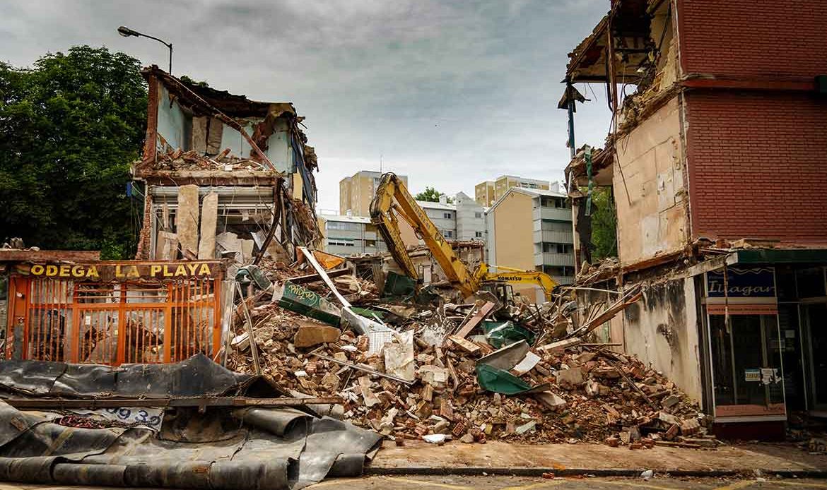
Earthquakes can have a significant impact on the affected regions, resulting in infrastructure damage, injuries, and loss of life. The seismic hazard in Panama and Costa Rica poses challenges to the safety and resilience of buildings, roads, and other critical infrastructure.
In Panama, historical earthquakes have caused notable destruction, such as the earthquake of 1882 that devastated the city of Panama and the earthquake of 1991 that caused widespread damage in the provinces of Chiriquí and Bocas del Toro. These events highlight the vulnerability of the region to seismic activity and the need for robust construction practices and emergency preparedness.
In Costa Rica, the impact of earthquakes is also significant. The 7.6-magnitude earthquake that struck the Nicoya Peninsula in 2012 caused severe damage to buildings and infrastructure in the affected area. This event serves as a reminder of the ongoing seismic hazard faced by the country and the importance of implementing rigorous building codes and safety measures.
It is crucial for both Panama and Costa Rica to prioritize earthquake-resistant infrastructure and disaster preparedness to minimize the impact of future seismic events. By investing in resilient construction techniques, early warning systems, and community education, these countries can enhance their ability to withstand and recover from earthquakes, safeguarding the well-being of their populations and reducing economic losses.

Table: Major Earthquakes in Panama and Costa Rica
| Year | Location | Magnitude | Impact |
|---|---|---|---|
| 1882 | Panama | Unknown | Devastated the city of Panama |
| 1991 | Panama | 7.7 | Widespread damage in Chiriquí and Bocas del Toro |
| 2012 | Nicoya Peninsula, Costa Rica | 7.6 | Severe damage to buildings and infrastructure |
Earthquake Safety Measures
When it comes to earthquake safety, implementing effective measures is of utmost importance to minimize the potential impact of seismic events and ensure the safety of individuals and communities. One crucial aspect of earthquake safety is the implementation of stringent building codes. These codes outline specific requirements for constructing structures in earthquake-prone areas, including guidelines for structural design, materials, and reinforcement. By adhering to these codes, buildings can be designed and constructed to withstand the forces generated by earthquakes, reducing the risk of collapse or serious damage.
In addition to building codes, structural resilience plays a significant role in earthquake safety. Structural resilience refers to the ability of buildings and infrastructure to withstand and recover from the effects of an earthquake. This includes designing structures with appropriate materials and construction techniques, as well as ensuring proper maintenance and periodic inspections. By enhancing the resilience of buildings, communities can minimize the potential for structural failure during seismic events, protecting lives and property.
Another important aspect of earthquake safety is the retrofitting of existing structures. Retrofitting involves strengthening older buildings to meet current building codes and seismic standards. This process may include adding support systems, reinforcing walls and foundations, or improving connections between different components of the structure. Retrofitting is essential in regions with a high concentration of older buildings that may not have been designed to withstand earthquake forces. By retrofitting these structures, their overall safety and resilience can be significantly improved.
Ensuring the Safety of Communities
Earthquake safety measures extend beyond individual buildings to encompass broader community-level strategies. Proper land-use planning and zoning can help mitigate the potential impact of earthquakes by restricting construction in high-risk areas or ensuring adherence to specific safety requirements. These planning measures can help prevent the development of densely populated or critical infrastructure areas in zones prone to significant seismic hazards.
Education plays a vital role in earthquake safety as well. Providing communities with information on earthquake preparedness and safety measures can empower individuals to take appropriate actions during seismic events. This includes teaching people to “Drop, Cover, and Hold On” during an earthquake, creating emergency plans, and assembling earthquake emergency kits with essential supplies. Regular drills and educational programs can help raise awareness and ensure that communities are better prepared to handle the impact of earthquakes.
| Earthquake Safety Measures | Key Points |
|---|---|
| Stringent Building Codes | Ensure structures are designed and constructed to withstand earthquake forces. |
| Structural Resilience | Enhance the ability of buildings and infrastructure to recover from earthquakes. |
| Retrofitting | Strengthen existing structures to meet current seismic standards. |
| Land-Use Planning and Zoning | Restrict construction in high-risk areas and enforce safety requirements. |
| Education and Preparedness | Empower communities with knowledge and resources to respond effectively during earthquakes. |
Conclusion
Earthquakes are a common occurrence in Panama and Costa Rica due to their tectonic settings. The subduction of the Cocos plate underneath the Caribbean plate and the Panama block in Costa Rica results in a high rate of seismic activity, with megathrust earthquakes occurring every 40 to 60 years. Repeating earthquakes, which provide valuable insights into fault physics and variations in the mechanical properties of the fault faces, have been observed in both countries.
Costa Rica has invested in earthquake monitoring and understanding tectonic processes. With a state-of-the-art geodynamic control network composed of seismic and geodetic instruments, Costa Rica’s Volcanological and Seismological Observatory manages one of the densest geophysical instrumental networks in Latin America and the world. This network has provided an incredible opportunity for monitoring and understanding earthquake processes along faults.
Earthquake preparedness, early warning systems, and safety measures are crucial for mitigating the impact of earthquakes in Panama and Costa Rica. Implementing stringent building codes, ensuring structural resilience, and educating communities on earthquake safety are all important aspects of earthquake mitigation. Ongoing research and collaboration in the field of seismology contribute to a better understanding of earthquakes and improved earthquake hazard assessment. If you like this article we invite you to keep following our blog about anything expat in Costa Rica or Panama, or download our app.
FAQ
What are repeating earthquakes?
Repeating earthquakes are events that occur in the same location at different times, generating highly identical seismic fingerprints.
Where have repeating earthquakes been observed in Costa Rica?
Repeating earthquakes have been observed recently in Costa Rica along the central Pacific, the Central Valley, and the Talamanca range.
What insights do repeating earthquakes provide?
Repeating earthquakes provide valuable insights into fault physics and variations in the mechanical properties of the fault faces during the earthquake cycle.
How is earthquake monitoring done in Costa Rica?
Costa Rica has a state-of-the-art geodynamic control network composed of over 70 sites, equipped with seismic and geodetic instruments.
What is the subduction process in Costa Rica?
Costa Rica is directly exposed to the subduction of the Cocos plate underneath the Caribbean plate and the Panama block.
What is the rate of seismicity in Costa Rica?
Costa Rica experiences a high rate of seismicity, with megathrust earthquakes occurring every 40 to 60 years.
What are earthquake early warning systems?
Earthquake early warning systems use seismic networks to detect and analyze earthquake activity in real-time, providing advanced alerts to affected areas.
What are some earthquake safety tips?
Some safety tips include creating an emergency plan, securing furniture, and practicing “Drop, Cover, and Hold On” during an earthquake.
How do earthquake detection systems work?
Earthquake detection systems utilize seismometers to measure ground motion caused by seismic waves and collect data for analysis.
What is the historical seismic activity in Panama?
Panama has a history of seismic activity, with documented earthquakes dating back to the 16th century.
What is the historical seismic activity in Costa Rica?
Costa Rica has experienced significant historical earthquakes, with documented events dating back several centuries.
What is the impact of earthquakes in Panama and Costa Rica?
Earthquakes can cause infrastructure damage, injuries, and loss of life, with the impact varying depending on factors such as magnitude and preparedness measures.
What are earthquake safety measures?
Earthquake safety measures include implementing building codes, ensuring structural resilience, and educating communities on preparedness.